1

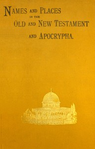
Names and places in the Old and New Testament and Apocrypha, with their modern identifications — A Reader’s Guide
1970
13
Project Gutenberg
2024
Bible -- Geography; Names, Geographical; Names in the Bible
Readers of public-domain and historical texts
Project Gutenberg digital edition
en
Edition facts
Words: 43,469
Reading time: 189 min
Text sections: 6
Source:
Project Gutenberg record #73117
This editorial note examines how the opening, middle, and later excerpts of Armstrong's gazetteer guide a first reading, focusing on its preface, entry structure, and handling of uncertain identifications.
The preface immediately establishes the work as a collaborative index, compiled by George Armstrong and revised by two Royal Engineers, Colonel Sir Charles W. Wilson and Major Conder. It lists sources including the Survey of Western Palestine, Smith's Bible Dictionary, and Conder's own handbooks, and notes that identifications match forthcoming maps. The preface also quantifies the scope: over 1,150 Old Testament sites, 162 New Testament sites, and 290 still unidentified places. This upfront accounting of known and unknown sets a tone of scholarly caution rather than certainty.
The Preface as a Roadmap
The preface does more than credit contributors. It reveals the work's method: identifications are drawn from multiple sources, with those from the Survey marked by a star. The statement that 290 places remain unidentified is striking—it admits incompleteness. For a first reader, this signals that the gazetteer is a tool for inquiry, not a final authority. The preface also notes that the index covers both sides of the Jordan, Mesopotamia, Edom, Sinai, and Egypt, giving a geographical breadth that the entries themselves confirm.
Entry Structure: Evidence and Uncertainty
Each entry typically lists biblical references, a proposed modern identification (often with a question mark), and a sheet number for the accompanying maps. For example, Lachish appears as "Umm Lâkis (?) or Tell el Hesy (?)*" with a note that Conder now proposes Tell el Hesy. The entry for Libnah (1) simply says "Not identified" and places it between Makkedah and Lachish. This pattern—offering a candidate but flagging doubt—recurs throughout. The use of asterisks, question marks, and phrases like "thought to refer to" or "probably identical with" trains the reader to weigh evidence rather than accept labels.
The Role of the Survey and Map References
Every identified site includes a sheet number for the large and small maps, such as "Sh. XX" for Lachish. This ties the text directly to cartographic output. The preface explains that the maps were to be issued around the end of 1888, making the gazetteer a companion volume. For a first reader, the map references are not mere metadata; they are an invitation to locate places spatially. The entry for Lebanon, for instance, gives "Jebel Libnân" and refers to Porter's Handbook, showing that the work expects readers to consult external sources for fuller description.
Handling of Unidentified and Uncertain Sites
A significant portion of entries are marked "Not identified"—for example, Kithlish, Kitron, Laban, and Lasha. Others, like Lasharon, are given a tentative identification with a question mark and asterisk. The entry for Lakum says "Not identified" but adds a geographical clue: "somewhere between Jabneel and the river Jordan." This practice of giving a region even when the exact site is unknown helps the reader place the name in a general area. The preface's count of 290 unidentified sites prepares the reader for such gaps, making the work honest about its limits.
First-time readers should approach this gazetteer as a starting point rather than a definitive list. The preface's transparency about sources and uncertainties, the consistent use of map references, and the candid marking of unidentified sites all encourage a critical eye. The work is best used alongside the maps it references and the survey memoirs it cites. Its value lies not in final answers but in the questions it raises about location, evidence, and the ongoing work of identification.
Reader reflection
Your personal reading reflection
Build a private reading journal entry for this title.
Your progress
0
/
10
2
Was reading this book enjoyable?
3
Would you pass this book on to a friend?
4
How much effort did this book require?
5
Could you apply anything you learned?
6
How strong was your personal connection to the text?
7
How clear did the writing feel?
8
How much did the book move you?
9
What is the main idea you are taking away?
10